Jurong East
Wayfinding

Enhancing Wayfinding in Jurong East for better navigation.

Scroll

Category

Design & Concept

Collaborators

Partner

LTA

Year

2026

Featured in

8days

01 — Overview

Navigating around Jurong East shouldn't be that confusing

A collaborative wayfinding project by me and Adiel Rusyaidi, together with LTA, to help residents and visitors navigate Jurong East's highly connected transport and commercial district.

Getting from the MRT station to the two bus interchanges should be one of the simplest journeys in the area. Instead, commuters face a web of linkbridges, escalators and covered walkways, with few cues on which way leads to which interchange.

By simplifying complex pedestrian routes into clear, accessible signage, the initiative aimed to improve everyday navigation and user experience.
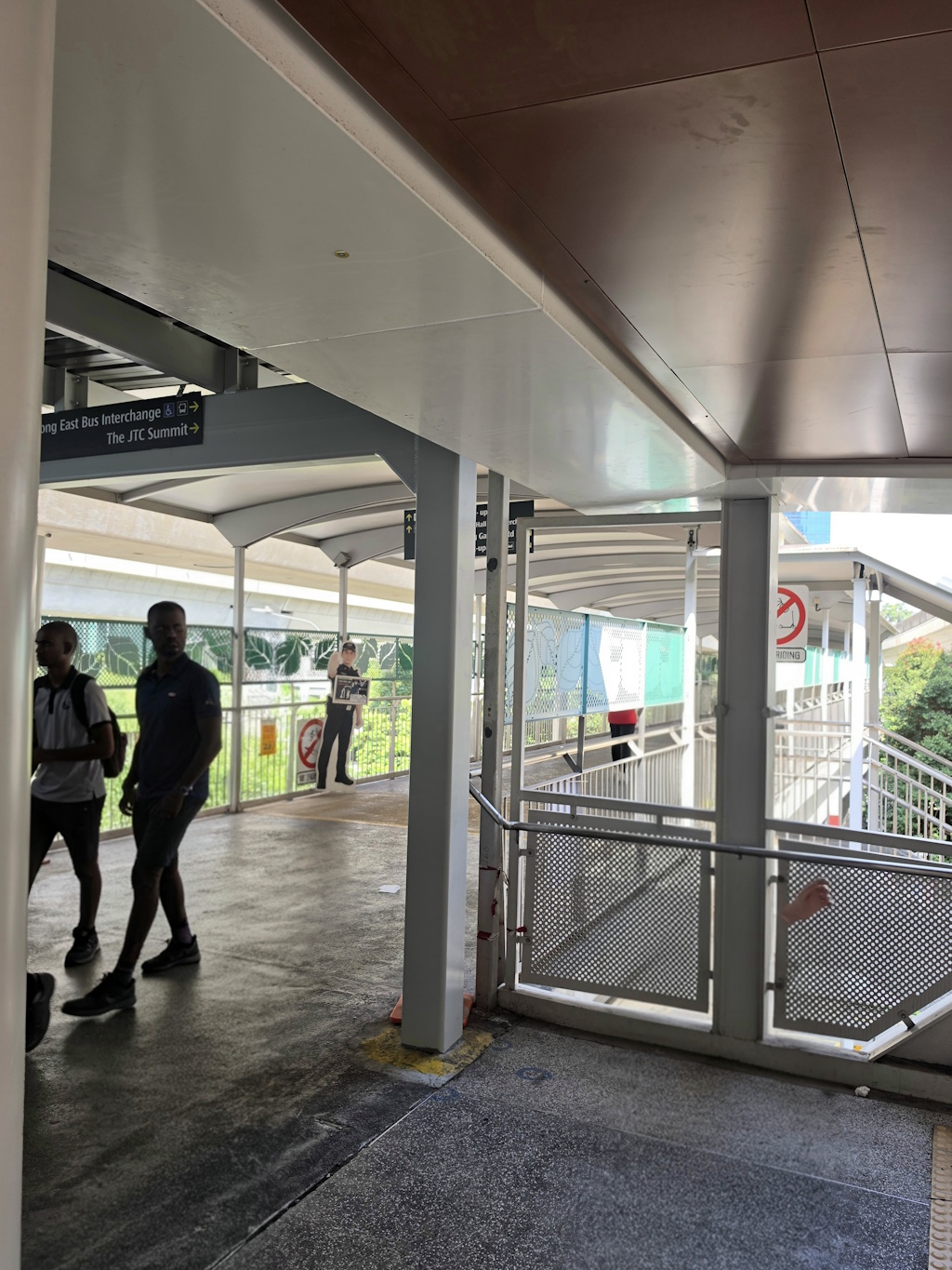
Covered walkway with Jurong East Bus Interchange sign
Covered walkway towards the interchange
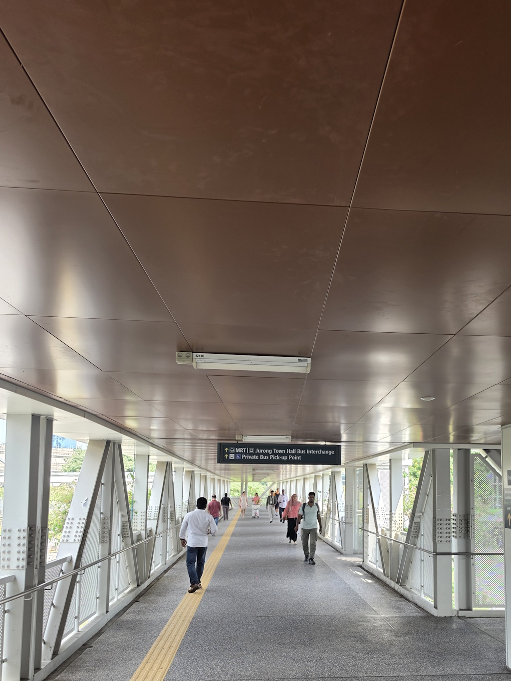
Walkway sign pointing to MRT and bus interchange
Overhead signs along the route
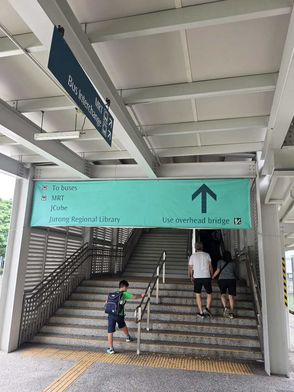
Staircase with signage to buses and MRT
Signage at the staircase
02 — Problem

Connected, but confusing

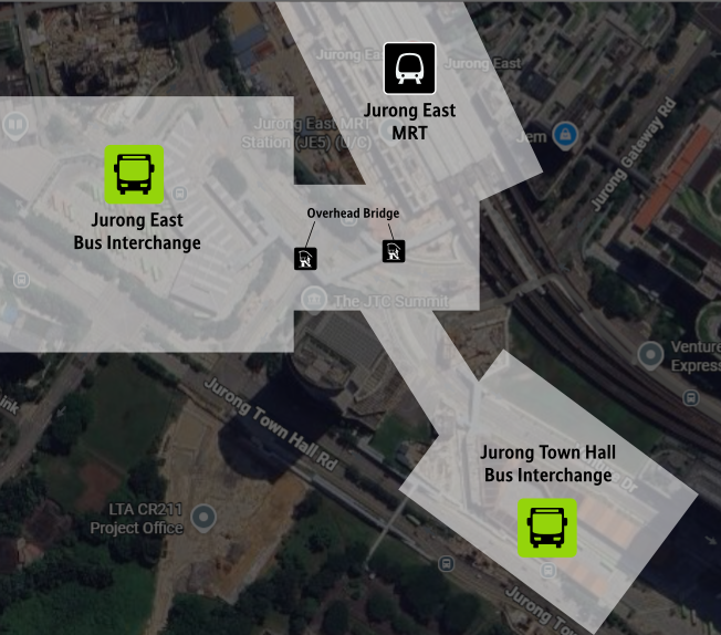
Jurong East, at its current state, links an MRT station, 2 bus interchanges, constructions for the upcoming Jurong Region Line and surrounding developmentsas well as a network of covered walkways and linkbridges. Great for connectivity but can be daunting for first-time visitors.

  • 2 Bus Interchanges but each of them serves different bus services.
  • Existing signs are inconsistent in style and information.
  • Visitors need to decide quickly, often when on the move or in a rush.
Map of Jurong East showing the MRT station and two bus interchanges
At a glance: Jurong East MRT station and the two bus interchanges
03 — Research

Site Walk-through

We walked the key journeys on foot — from the station to the bus interchanges, noting decision points, confusing areas and opportunities for clearer signage.

  • Site walk-throughs and photo documentation.
  • Mapping of key origins, destinations and decision points.
  • Review of existing LTA signage standards and how we can apply it to our wayfinding designs which we would be developing after the research phase.
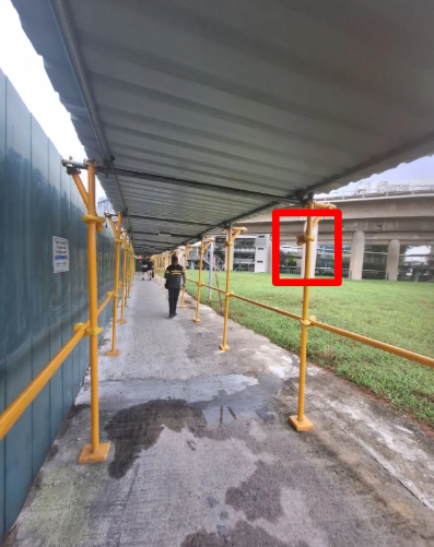
Covered walkway beside construction hoarding, with a highlighted area
Site walk-through along a covered walkway, with the highlighted area marking a spot to review.
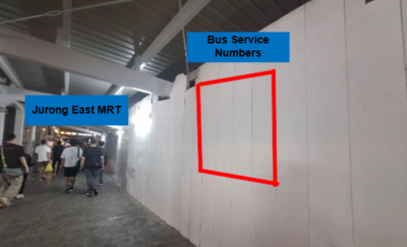
Annotated photo of the route from Jurong East MRT
Annotated photo from the MRT side, marking where bus service information could be placed.
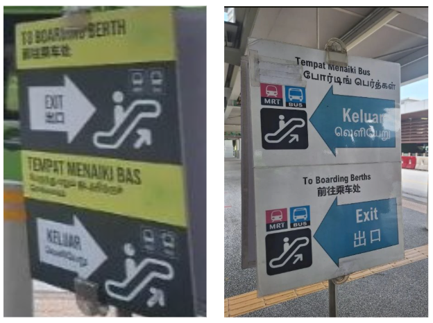
Existing boarding berth signs in different styles
Existing signs to the boarding berths, which differ in style and information.
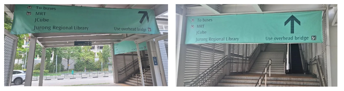
Existing overhead bridge signs listing buses, MRT, JCube and Jurong Regional Library
Existing overhead bridge signs listing buses, MRT, JCube and Jurong Regional Library.
04 — Ideation

From different mockups to a finalized design

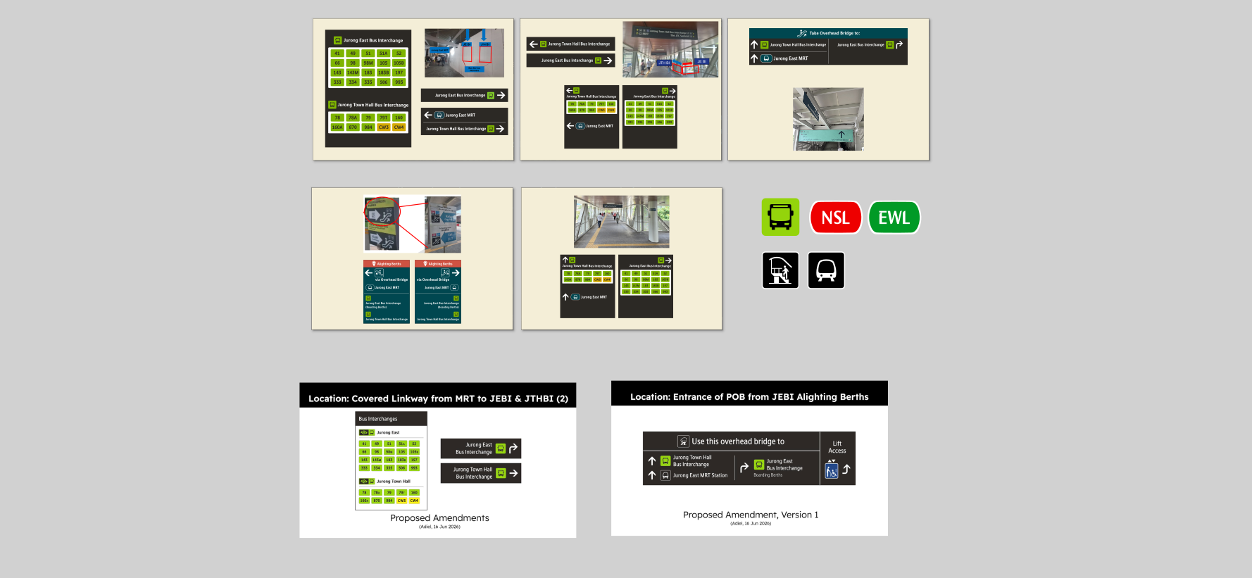
Each of us began developing our own designs at first, to see which of our designs align with LTA's Design Principles and requirements. Although we started with different approaches, we converged on a consistent system that addressed hierarchy, colour, iconography and legibility.

  • Familiarity with existing transport signage.
  • Colour and iconography aligned with existing transport identity.
  • Legibility at walking pace and from a distance.
  • Easily understood at a glance by commuters and visitors.
Ideation sketches
05 — Design

Clear, accessible signage

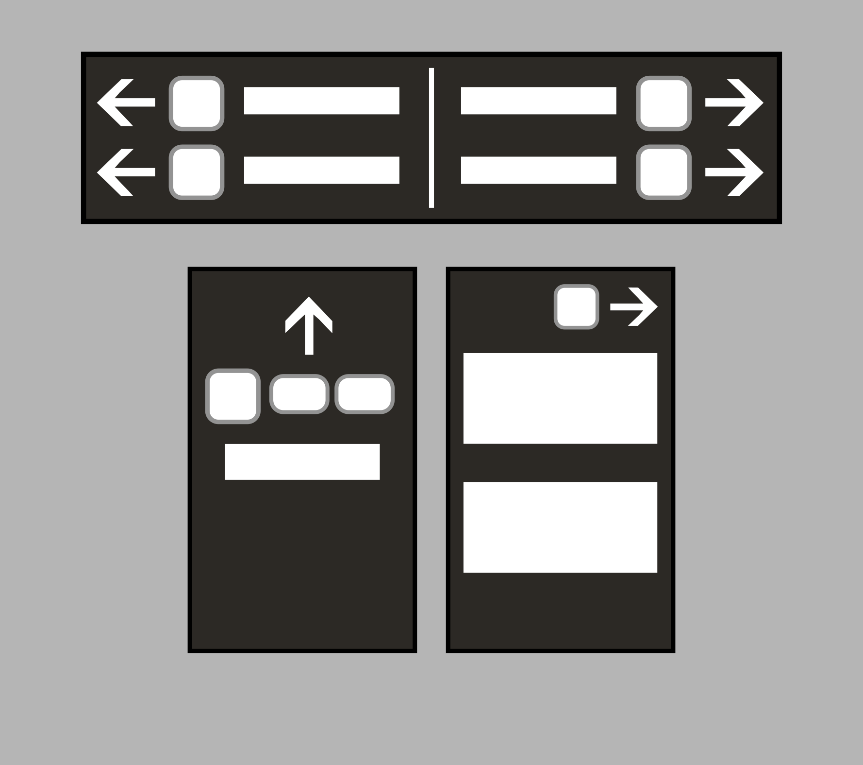
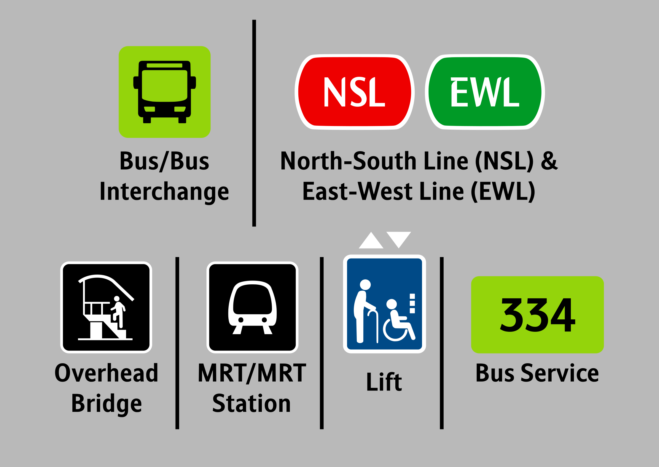
The final design language pairs strong contrast and generous type sizes with simple pictograms, so a sign can be understood in a glance by locals, tourists and commuters alike.

Jurong East wayfinding sign design Jurong East wayfinding sign detail
06 — Implementation

On the ground

Working with LTA, the designs moved from mockups to actual installation in Jurong East. LTA provided guidance and approvals throughout the process to ensure compliance with their standards.

Installed wayfinding signage Installed wayfinding signage in context

Image courtesy of Vareck Ng.

07 — Public Reception

What people said

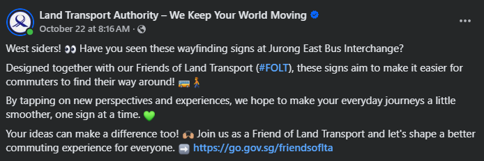
Once installed, the signs drew public attention, with LTA and commuters sharing them online.

08 — Conclusion

What I learnt

The project gained significant public attention and was featured by 8days. Looking back, the result came from every stage connecting to the next: understanding the routes, aligning on one design, and working with LTA until it was installed.

Research

Walking the routes from the station to both bus interchanges showed where people hesitate. Signs should answer those decisions, not just fill space.

Ideation

Starting with separate designs let us test ideas against LTA's design principles, then converge on one consistent system.

Design

Familiar colours and icons, strong contrast and generous type let a sign be understood at a glance, even when rushing.

Coordination

LTA's guidance and approvals, and working closely with my collaborator, kept the designs compliant and moving from mockup to installation.

Special thanks to LTA and my collaborator, Adiel for their contributions and support throughout the project.